


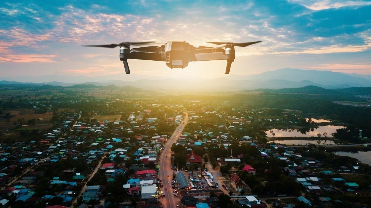
In recent years, drone technology has rapidly advanced from a niche hobbyist pursuit to a transformative tool in various industries, including real estate and land development. This shift is particularly evident in New Zealand, where the scenic landscapes and unique geographical features present both opportunities and challenges for developers. The integration of drone footage into land development marketing strategies is revolutionizing how properties are presented and perceived, creating a competitive edge for those who harness its potential. This article delves into the reasons behind this transformation, backed by data, expert insights, and real-world examples.
The Power of Aerial Storytelling
Imagine standing at the edge of Lake Wakatipu, with the Remarkables mountain range looming majestically in the background. A drone can capture this breathtaking view, providing potential investors or buyers with a perspective that ground-level photography simply cannot match. The ability to showcase expansive views and the surrounding environment is a powerful tool in the land developer’s arsenal.
Drone footage offers a unique storytelling medium that can convey the full potential of a development site. By flying over the site, drones can highlight key features, access points, and the surrounding community, creating a narrative that resonates with prospective buyers. This form of storytelling is not just about showcasing the property; it's about selling a vision.
Case Study: Queenstown Lakes District
In the Queenstown Lakes District, a renowned area for its stunning natural beauty, developers have leveraged drone technology to enhance marketing efforts. A prominent real estate firm employed drones to create a virtual tour of a new housing development, showcasing not only the properties but also the connectivity to local amenities and the breathtaking landscapes. The result was a significant increase in inquiries and a quicker turnaround on sales, demonstrating the impact of drone footage in elevating the marketing narrative.
Pros and Cons Evaluation
Benefits of Drone Footage in Land Development
- Comprehensive Views: Drones provide a bird's-eye view of the property and its surroundings, offering a comprehensive visual representation that is invaluable in the decision-making process.
- Cost-Effective: Compared to traditional aerial photography methods, drones offer a more affordable and flexible solution. According to Stats NZ, the cost of drone operations is significantly lower than hiring a helicopter or plane for aerial shots.
- Enhanced Engagement: Marketing materials featuring drone footage tend to engage viewers more effectively. A study by MBIE found that listings with drone footage had a 30% higher engagement rate than those without.
- Innovative Marketing: Utilizing drones can differentiate a development project from competitors, positioning it as cutting-edge and forward-thinking.
Challenges and Limitations
- Regulatory Compliance: Operating drones requires adherence to Civil Aviation Authority (CAA) regulations in New Zealand, which can be complex and time-consuming.
- Weather Dependency: Drone operations are heavily dependent on weather conditions, which can be unpredictable in certain regions of New Zealand.
- Privacy Concerns: The use of drones raises privacy issues, especially when flying over populated areas, requiring careful navigation of legal and ethical boundaries.
- Technical Expertise: Effective use of drones requires technical skills for both piloting and footage editing, necessitating investment in training or hiring skilled personnel.
Beginner to Advanced Guide to Implementing Drone Footage
For property developers new to drone technology, starting with a clear strategy is crucial. Here’s a step-by-step guide from beginner to advanced implementation:
Beginner Steps
- Research Regulations: Understand the CAA regulations and obtain necessary certifications or permissions.
- Invest in Equipment: Start with a reliable, user-friendly drone suitable for real estate photography.
- Hire an Expert: Consider hiring a licensed drone operator to handle initial projects and provide guidance.
Intermediate Steps
- Enhance Skills: Invest in training for in-house staff to manage drone operations internally.
- Explore Advanced Features: Utilize drones equipped with features like 4K video and 3D mapping capabilities.
- Integrate with VR: Combine drone footage with virtual reality technology to create immersive property tours.
Advanced Strategies
- Data Analysis: Use drone footage to gather data and insights about land topography and development potential.
- Customized Marketing Campaigns: Develop tailored marketing campaigns using drone footage to target specific buyer demographics.
- Continuous Innovation: Stay updated with the latest drone technologies and trends to maintain a competitive edge.
Industry Deep Dive: Expert Insights and Emerging Trends
Dr. Amanda Hughes, a property market researcher, emphasizes the growing role of drone technology in providing a competitive advantage in land development. She notes, "In an era where visual content is king, drone footage offers an unmatched ability to capture the essence of a property and its potential. This technology not only enhances marketing efforts but also aids in strategic planning and decision-making."
Emerging trends, such as the integration of artificial intelligence with drone technology, are poised to further revolutionize the industry. AI can enhance the analysis of drone footage, providing deeper insights into land suitability and development potential. This synergy between AI and drones is expected to drive efficiency and innovation in New Zealand's property development sector.
Common Myths and Mistakes in Drone Usage
Myth vs. Reality
- Myth: "Drone footage is only for large-scale developments." Reality: Even small-scale projects can benefit from drone footage, which adds a professional touch and broader perspective, enhancing appeal.
- Myth: "Drones are too expensive for most developers." Reality: The cost of drones has decreased significantly, making them accessible for projects of various sizes.
- Myth: "Drone footage is just a marketing gimmick." Reality: Beyond marketing, drones provide valuable data for site analysis, planning, and project management.
Common Mistakes
- Overlooking Regulations: Failure to comply with CAA regulations can lead to legal issues and fines. Always ensure compliance to avoid setbacks.
- Ignoring Weather Conditions: Attempting drone flights in unsuitable weather can result in poor footage quality and potential equipment damage.
- Neglecting Post-Production: Raw footage requires editing to enhance visuals and create compelling narratives. Invest in quality editing to maximize impact.
Future Trends and Predictions
Looking ahead, the future of drone usage in land development marketing in New Zealand appears promising. According to a report by NZTech, the adoption of drone technology is expected to increase by 30% over the next five years, driven by advancements in AI and data analytics. This growth will enable more precise land assessments and innovative marketing strategies.
Furthermore, as environmental sustainability becomes increasingly important, drones will play a crucial role in monitoring environmental impact and ensuring compliance with sustainability standards. This aligns with New Zealand's commitment to reducing carbon emissions and promoting eco-friendly development practices.
Conclusion
The integration of drone footage into land development marketing is transforming the property landscape in New Zealand. By providing unparalleled visual storytelling, cost-effective solutions, and innovative marketing strategies, drones offer significant advantages for developers. As technology continues to evolve, embracing drone technology is not just a choice but a necessity for staying competitive in the dynamic real estate market. To succeed, developers must navigate regulatory challenges, invest in expertise, and continuously innovate to harness the full potential of this transformative tool.
Ready to elevate your property marketing strategy? Share your thoughts and experiences with drone technology in the comments below!
Related Search Queries
- Benefits of drone footage in real estate
- Drone regulations in New Zealand
- How to use drones for property marketing
- Impact of drones on real estate sales
- Future of drone technology in land development
People Also Ask (FAQ)
How does drone footage impact land development marketing in New Zealand? Drone footage enhances land development marketing by providing comprehensive views, improving engagement, and creating innovative marketing strategies that increase sales and interest.
What are the biggest misconceptions about drone usage in real estate? A common myth is that drones are too expensive and only for large projects. However, affordable options exist for various project sizes, and drones offer benefits beyond marketing, such as site analysis and planning.
What upcoming changes in New Zealand could affect drone usage? By 2026, policy updates in aviation and environmental regulations may impact drone operations, requiring developers to stay informed and compliant.
For the full context and strategies on Why Drone Footage Is Transforming Land Development Marketing in NZ, see our main guide: Nz Holiday Rentals Airbnb Video Tours.