
6.9K Views· 08 November 2025
DJI Zenmuse L3 – Precision LiDAR Redefined for Professional Aerial Mapping
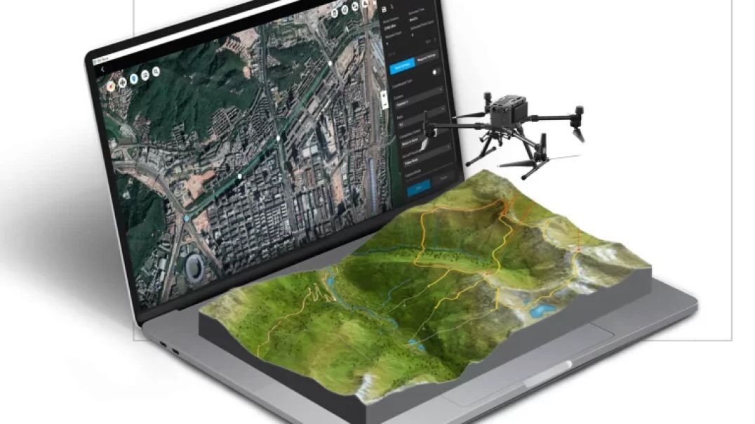
The DJI Zenmuse L3 represents the next generation of professional aerial LiDAR technology — built for surveyors, engineers, and mapping specialists who demand accuracy, range, and efficiency. Designed for the DJI Matrice series, this advanced payload integrates long-range LiDAR, dual RGB cameras, and a stabilized 3-axis gimbal, delivering unmatched data quality from a single flight.
At its core, the L3 features an ultra-sensitive laser scanner capable of detecting objects up to 950 meters away, capturing dense and highly accurate point-cloud data even in complex environments. Its system supports multiple laser returns per pulse, allowing it to penetrate vegetation and capture terrain details ideal for forestry, energy, and infrastructure applications.
Complementing the LiDAR is a dual 100-megapixel RGB imaging system, capturing vivid color imagery perfectly aligned with the LiDAR point cloud. Together, these systems provide true-color 3D models and ultra-precise terrain maps that streamline analysis and project planning.
Built with an IP54-rated enclosure and optimized for stability, the Zenmuse L3 maintains performance in demanding conditions. Its intelligent scanning patterns and real-time data preview make large-scale mapping faster, more reliable, and more efficient than ever.
With the Zenmuse L3, DJI brings survey-grade precision and productivity to the skies — transforming how professionals measure, inspect, and map the world.
#djizenmusel3 #dronelidar #aerialmapping #djienterprise #surveyingtechnology #3dmodeling #infrastructureinspection #precisionmapping #geospatialdata #aerialinnovation


Building a USGA Putting Green in 4 Minutes – Precision, Speed, and Turf Perfection


Meet DJI Mini 5 Pro – The Ultimate 1-Inch CMOS All-in-One Mini Camera Drone 🚁📸


The All-New Bentley Bentayga Now in New Zealand | Extraordinary Luxury SUV Redefined
Meet the Latest DJI Terra Powered by 3D Gaussian Splatting for Next-Level Mapping in New Zealand


Porsche Museum Drone Tour – Exclusive Aerial Experience Now Streaming in NZ

IWC Portugieser Automatic 42 (Ref. IW501705) – Timeless Precision, Redefined


Up next
Building a USGA Putting Green in 4 Minutes – Precision, Speed, and Turf Perfection
Meet DJI Mini 5 Pro – The Ultimate 1-Inch CMOS All-in-One Mini Camera Drone 🚁📸
The All-New Bentley Bentayga Now in New Zealand | Extraordinary Luxury SUV Redefined
Meet the Latest DJI Terra Powered by 3D Gaussian Splatting for Next-Level Mapping in New Zealand
Porsche Museum Drone Tour – Exclusive Aerial Experience Now Streaming in NZ
34 Comments
voxolivia01869
1 day agoWeiser Law Firm
3 days agoGeoffreyEi
3 days agoFocal limited
4 days agoUAND Solutions
5 days ago